
Parker Road & Mainstreet Intersection Improvements
The Town of Parker, along with the consultant team from Kimley Horn, are advancing the Parker Road (State Highway 83) and Mainstreet Intersection Operational Improvements Conceptual Design Project. The purpose of the project is to enhance mobility, safety, and operations at one of the community’s most important gateways. Serving both as a principal regional corridor and the front door to downtown Parker, this intersection must balance commuter traffic with local access, walkability, community character and economic vitality.
Building on previous planning efforts, including the Parker Road Corridor Plan (2019), and in coordination with regional partners, stakeholders, and the public, the Project will evaluate and refine transportation solutions to improve traffic flow, strengthen multimodal connections, and support downtown Parker’s long-term vision as a vibrant, connected, and walkable cultural and economic hub.
The Project is currently considering a range of potential design alternatives. Opportunities to review and provide input on alternatives will be available at an upcoming Open House this spring.
Please follow this page for future opportunities to share feedback and attend planned open houses. Submit questions using the Q&A form below.
May 7 Open House Recap
Were you unable to attend the May 7 project open house? Use the links below to access information shared with those in attendance.
- Project Fact Sheet
- May 7 Public Open House - Display Boards (includes three conceptual design options)
Project Overview
The Parker Road and Mainstreet intersection is a critical transportation hub serving regional mobility needs while functioning as the primary gateway to downtown Parker. As traffic volumes, multimodal activity, and redevelopment opportunities continue to grow, the Town of Parker is evaluating operational and design improvements to safely and efficiently serve motorists, pedestrians, cyclists, and transit users—today and in the future.
This Project builds upon and is informed by prior plans and studies, including:
- State Highway 83 Corridor Optimization Plan (2004)
- State Highway 83 Access Management Plan (2004)
- Parker Mainstreet Master Plan (2015)
- Parker Downtown Safety and Circulation Study (2018)
- Parker Road Corridor Plan (2019)
- Parker 2035 Master Plan (updated 2022)
- Parker 2050 Comprehensive Plan (in progress)
Project Purpose
- Improve the current and future operations and safety of the Parker Road and Mainstreet intersection.
- Improve traffic flow for both local drivers and regional travelers.
- Support a more connected and walkable downtown Parker.
- Maintain or improve access to O’Brien Park and O’Brien North.
Why Improvements Are Needed
- The intersection and surrounding road network experience congestion and operational challenges that reduce overall performance and connectivity.
- Safety and comfort for drivers, pedestrians, and cyclists are concerns at and near the intersection.
- Current transportation conditions limit support for downtown Parker’s economic vitality and planned growth.
- Neighborhoods, businesses, and community spaces on both sides of Parker Road are not well connected, creating barriers to east–west travel.
What the Conceptual Design Phase Will Deliver
- Meaningful collaboration with stakeholders and the community.
- Identification of a preferred alternative for advancement into preliminary engineering.
- Conceptual design of intersection improvements.
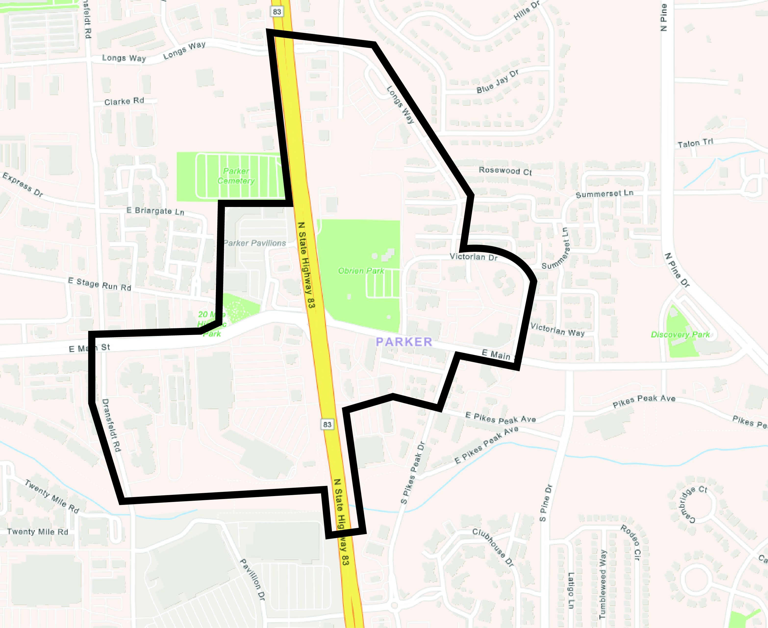
Study Area
The project focuses on the Parker Road and Mainstreet intersection and surrounding downtown area, generally extending from 20 Mile Road to Pine Drive and from Longs Way to Hilltop Road. The intersection currently operates as a multi-lane, signalized configuration with sidewalks and crosswalks and serves as a key east–west and north–south connection.
Future Next Steps
Once a preferred alternative is chosen, the Town will seek funding sources to proceed with the next design phases and, ultimately, construction of the improvements. These next steps are currently unfunded, and no completion timeline has been established. The present study will provide recommendations regarding these future actions.

Who's Listening
-

Phone (303) 805-3174 Email bmatthews@parkerco.gov -

Phone (303) 805-3337 Email mmunekata@parkerco.gov -

Phone (303) 805-3336 Email hbennett@parkerco.gov -

Phone 303-805-3168 Email wfeazell@parkerco.gov -

Phone (303) 805-3202 Email daden@parkerco.gov